The Supramonte mountain range in eastern Sardinia is 35,000 hectares of karstic highlands. Their sharp limestone peaks, deep ravines, canyons and caves remain little visited by tourists to Sardinia, who stick mainly to the beaches on the coast. But the interior is slowly gaining recognition as a great place for hikers seeking peaceful and relatively unspoilt trails.
With our UK friends, David and Noreen, we headed to Oliena, a small town at the foot of the mountains, for a week of hiking in the hills.
Day 1: Mt Maccione to Su Gologone Spring
Our hike began from our little hotel nestled on the side of Mt Maccione with a beautiful view over the valley and of Oliena down below.

The trail headed off into the woods on a clear blue day.

It got a bit lumpy at times but overall it was an easy hike.


We lost the trail and found ourselves at a dead end next to a sheep enclosure. A young shepherd whose dog had alerted him to the presence of strangers came from far across his fields to investigate. He didn’t speak a word of English but went a long way out of his way to guide us back to a path that led to where we needed to go.
There are trails all over these hills, mostly old shepherd’s paths, some now waymarked for walkers. We didn’t see another person all day, until we emerged from the trail at the Su Gologone Spring reserve.

Rain falling on the limestone peaks of the Supramonte mountains seeps down fissures in the rock, feeding into streams deep underground. The water travels through subterranean cave networks until it eventually re-surfaces in the form of a spring here. It is the final outflow point for Italy’s largest underground river system.
The underground systems are so complex, they have never been mapped and the exact sources of the spring water are still unknown. One thing that’s certain is that the catchment is big. In 1999, speleologists poured non-toxic dye into an underground stream on the opposite side of the Supramonte range and waited. More than a month later, it emerged at Su Gologone.

Another is that it’s deep. Successive attempts over many years by experienced divers have failed to reach the bottom. The current record was achieved in May 2010 when a team headed by Albert Cavedon – a fitting name for a cave diver – descended to a depth of -135 metres. The system continued down but they could not. Cavedon returned two years later and successfully duplicated his performance but couldn’t get any deeper.

This time of year, the end of the long dry summer, the spring is pushing out a gentle flow of around 500 litres per second. But after heavy rains, the flow becomes a 10,000 litres per second torrent.
The water is pristine, crystal clear and deliciously cold. Thirsty hikers can fill up at the pool which park authorities have created to divert some of the water. Just obey the signs that say ‘no foot bathing’!

Total walk distance: 11km
Day 2: Sa Ocha – Mt Tiscali – Flumineddu Valley
Our second day’s hike was from the Lanaittu valley up to the remains of a Neolithic village on the peak of Mt Tiscali and then down to the Flumineddu Valley on the other side.
This area was the centre of the Nuraghic civilisation which existed in Sardinia during the Bronze Age, around 1800 BCE. Little is known of their ethnic origin as the culture has no surviving written records. All that remains today are remnants of the stone buildings constructed during the period, fragments of ceramic and small bronze objects.
Along the Lanaittu Valley the Nuraghi lived in caves and under rock overhangs.

The walk was initially flat but we knew to expect a long, hot climb up the mountain.
About 30 minutes in, we came to a fork with a choice.
To the right, goat cheese, olive oil and wine at the farm gate.
 To the left, the ascent of Mount Tiscali, which our notes described as having “technically difficult parts on narrow, steep and very rocky paths”.
 The wine and cheese were tempting, even if it was only 9.30am. But we were here to hike, so with a twinge of regret, we turned left.
The trail was actually quite benign for most of the ascent, just a final kilometre or so where jagged rocks and scaling steep sections required care.
 It was a hot climb but eventually we reached the top.
Mount Tiscali is in the centre of the Supramonte range and it’s 518 metre peak is one of the most inaccessible sites of human settlement found in Sardinia.
At the summit is an enormous sinkhole.
 Inside the sink hole are the remains of an ancient village which once included hundreds of free-standing round dwellings as well as many built into the side of the hole. Artifacts from the Nuraghic age have been found here, so it is assumed these people were the first inhabitants. But the Nuraghic civilisation has been extinct since at least 4-500 BCE and there is evidence of more recent occupation. It is speculated that a later, as yet unidentified, indigenous people hunkered down here to avoid oppression by the Romans after they annexed Sardinia in the 200s BCE.
The village is completely invisible until you are actually above it. After a steep descent in, you can walk a circuit inside to see the remains.

 There’s not a lot left, but the physicality of the place is unlike anything we’ve seen elsewhere. We were struck by two thoughts.
First, whoever occupied this place really didn’t want to interact with the outside world.
Second, we felt sorry for the attendant who has to hike all the way up here and down again every working day to collect the 5 euros per person which the relevant authority charges the few visitors who come.
After re-tracing our path down the steep, needle like rocky track, we turned onto the Scala Surtana – the Surtana Staircase – a trail which zigzagged down to the forest floor with the occasional random shrine along the way.
 It flattened out to a really pleasant stroll.
 Ending at the Flumineddu River in time for an iced tea from a strategically located kiosk before our pick up.
 Total walk distance: 13km
Day 3: Dorgali to Cala Gonone
After a night in Dorgali, today’s walk started with a footpath up the ridge line above town, with fine views down to the valley famous for the production of Canonau wine, a grape variety found only in Sardinia.


The hike over the mountain was made easier by a tunnel cut through in 1838.
 On the other side, the trail wound steadily down. Long sections of loose rock made for slow progress but our destination, the town of Cala Gonone eventually came into sight.
 As well as distant views to the cove beaches dotted along this coast which are accessible only by boat.
 We were hot and sweaty by the time we reached Cala Gonone, but in time for lunch, a swim and a gelato before catching the bus back to Dorgali.
 Total walk distance: 14km
Day 4: Gorropu Canyon
Believed to be one of the largest canyons in Europe, and generally billed as ‘Sardinia’s most spectacular’, an optional extra day to hike the Gorropu Gorge was a no-brainer.
The trail starts flat, following the Flumineddu River.
 Along a 5km walk, the mountains gradually close in, until you reach the beginning of the canyon.
 First up, follow the green dots. For some perspective on size, spot the man toward the far end of this section.
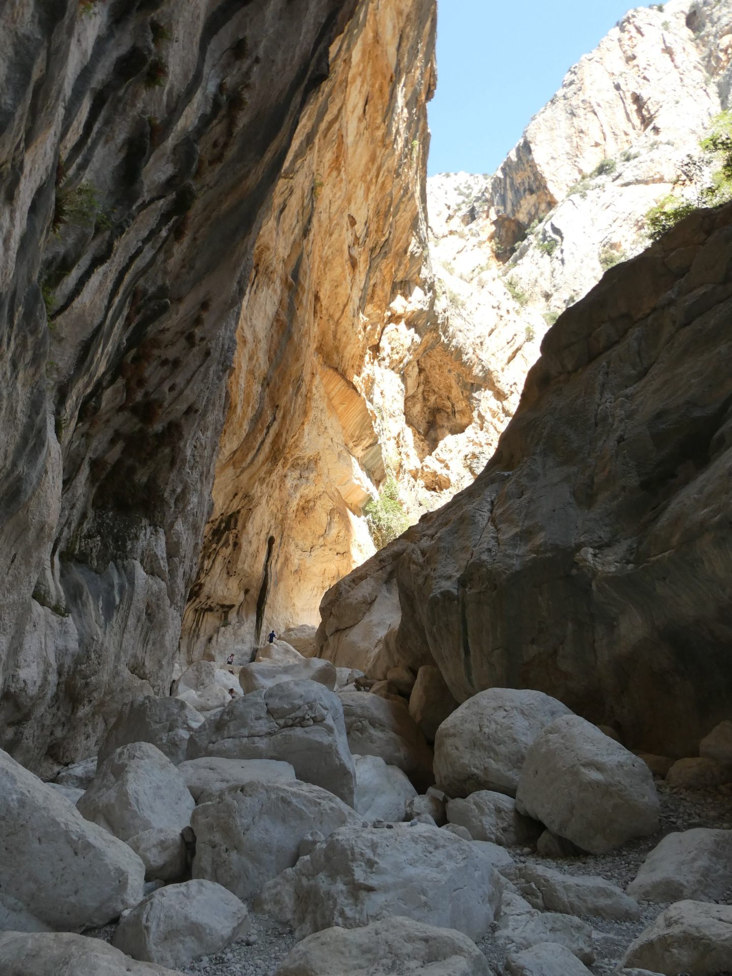
Some slithering through the rock fall was required. Here’s Noreen squeezing through one of them.

After the green dots, a section of yellow dots signifies a more challenging section.
 As the boulders piled up, clambering over them got a bit tricky. These limestone rocks, weathered smooth over millenia, are like glass underfoot. Here’s David climbing through the yellow zone.

By the end of the yellows, the canyon has narrowed to a mere five metres across.

A sign marks the start of the red zone. Hikers cannot go any further without an authorised guide. Technical climbing expertise and equipment are required. But David thought he’d take a look.
 Just a quick look from the first rocks. For mere mortals, it’s impassable from here.
And since it’s a linear walk, all we had to do then was the whole thing in reverse.
An incredible natural phenomenon and well worth the effort.
Total walk distance: 15km
Day 5: Golgo Plateau to Cala Goloritze
The mercury was rising a couple of points every day. Today it was a real challenge.
The walk started on the Golgo Plateau. A bone dry landscape of spiky trees and wild donkeys where Wild West saloons and gunslinging cowboys wouldn’t have looked out of place.

 The trail skirted Su Sterru. At 270 metres, it is one of the deepest sink holes in Europe. From the surface it really just looks like a dark hole.

We reached a car park full of cars, and people heading down a rocky path to Cala Goloritzè, the beach at the bottom of the these cliffs.
 The climb down isn’t technically hard. But it takes at least an hour and a half, mostly in full sun. Part way down you can spot Punta Salinas, a rock pinnacle shooting straight out of the cliff at sea level.
 Rock climbers with more daring than the average human inch their way to the top. In the next photo you might just be able to see the fellow at the top left.
 But for most, the attraction is the beach at the base.

 Many beach goers come by boat, but a fair number walk down as well. We had lunch and bobbed around in the ocean for a while. It was great to cool off, but then you have to walk back up. Two hours in the stinking heat destroyed the therapeutic effect of the swim.
Even taking out the additional walking we’d done hiking on the plateau, we were perplexed by the number of people prepared to come here. Sure, they can park at the top and walk down, and the beach is lovely. But two hours each way for a swim? Can’t see too many Australians putting up with that.
Total walk distance: 12km
Day 6: Santa Maria Navarrese to Pedra Longa
We thought yesterday was hot, but this was absolutely beyond the pale.
This should have been an easy, comfortable walk: from our hotel in Santa Maria Navarrese along the cliffs to the rock pinnacle of Pedra Longa, and return. A relatively flat track and a modest 15km return.
It was a short walk to the top of the cliffs, with a view back over town and the marina. So far, so good.
 Nice views along the coast and a beautiful clear day.
 But the heat was extreme. We later discovered it was 34 degrees Celsius but with humidity at 68%, the meteorological advice was “feels like 43 degrees”. And it did.
Most of the hillside has been burned to a crisp by the long hot summer. We passed some goats chewing on the dried out shrubbery.


We could see Pedra Longa in the distance.
 We pressed on. David’s hat was so saturated with sweat, the brim was actually dripping. John looked like he’d been standing fully clothed under the shower. We were all thinking of poor Michael Mosley dying of heat stroke in Greece earlier this year.
We got this far:
 And we decided that was a good enough view of Pedra Longa. Back to town for cold drinks, gelato and a swim.
Total walk distance: 12km
Day 7: Teletotes to Cala Luna
After yesterday’s debilitating experience, we weren’t sure we wanted to do the last hike. But thankfully the temperature dropped overnight, with a predicted top of only 30 degrees today, so we headed off. And it turned out to be our favourite hike of this trip.
We hiked down the Codula di Luna, a rocky gorge between limestone cliffs.
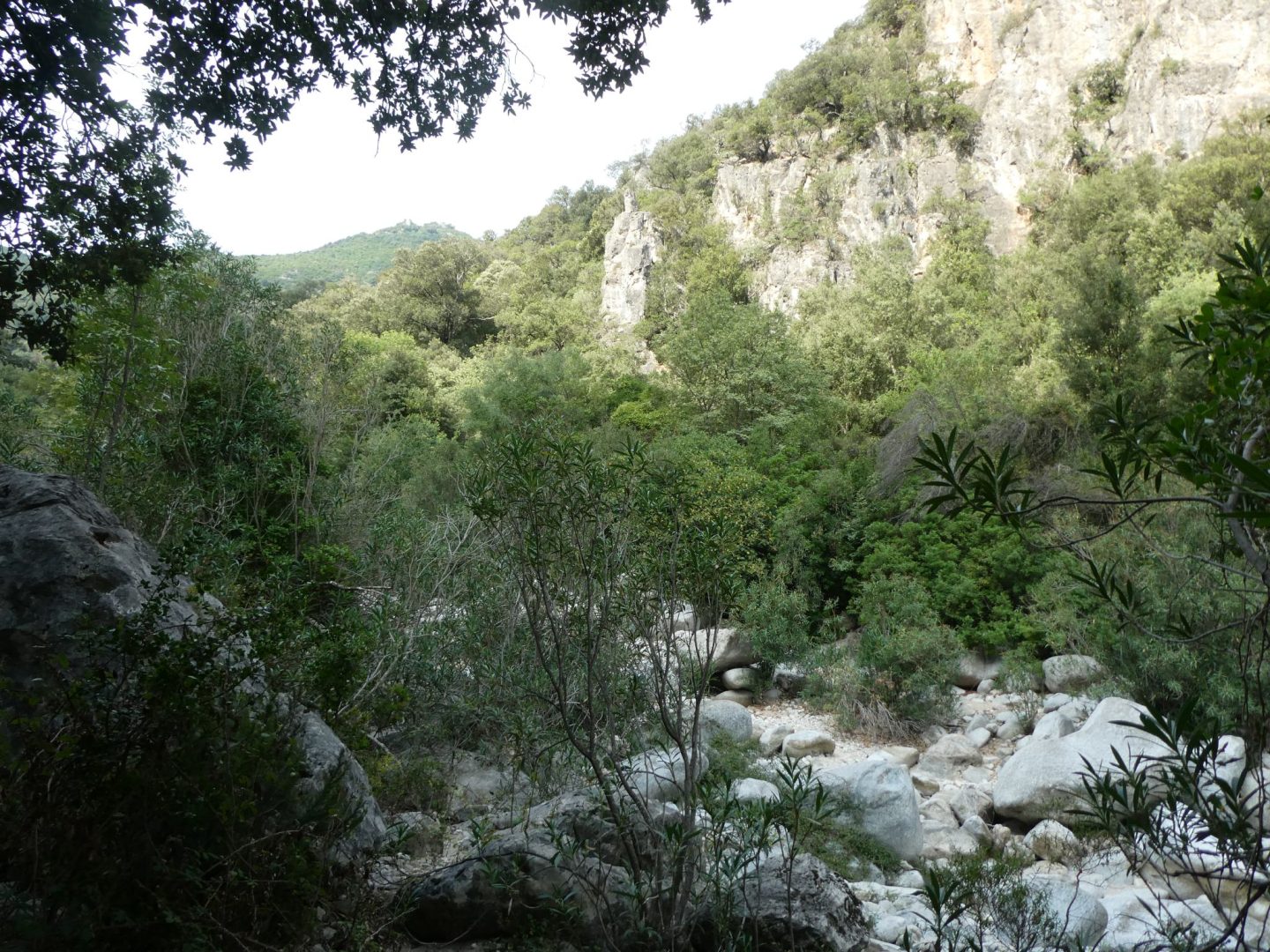


More boulder hopping but not as tricky as the Gorropu Gorge.

The boulders gave way to sand.
 And eventually we popped out at one of Sardinia’s most beautiful beaches, Cala Luna.
 As well as a pristine white beach, there’s a line of caves providing shade.


And unlike Cala Goloritze, here we could catch a boat back to town. No backtracking up the big hill!
Total walk distance: 12km
Cala Gonone
Walking done, we spent four nights in Cala Gonone, a quiet beach town near where we finished. Calm beach, some decent restaurants, a good place to chill looking over the ocean from the balcony of our room above the gelato parlour.

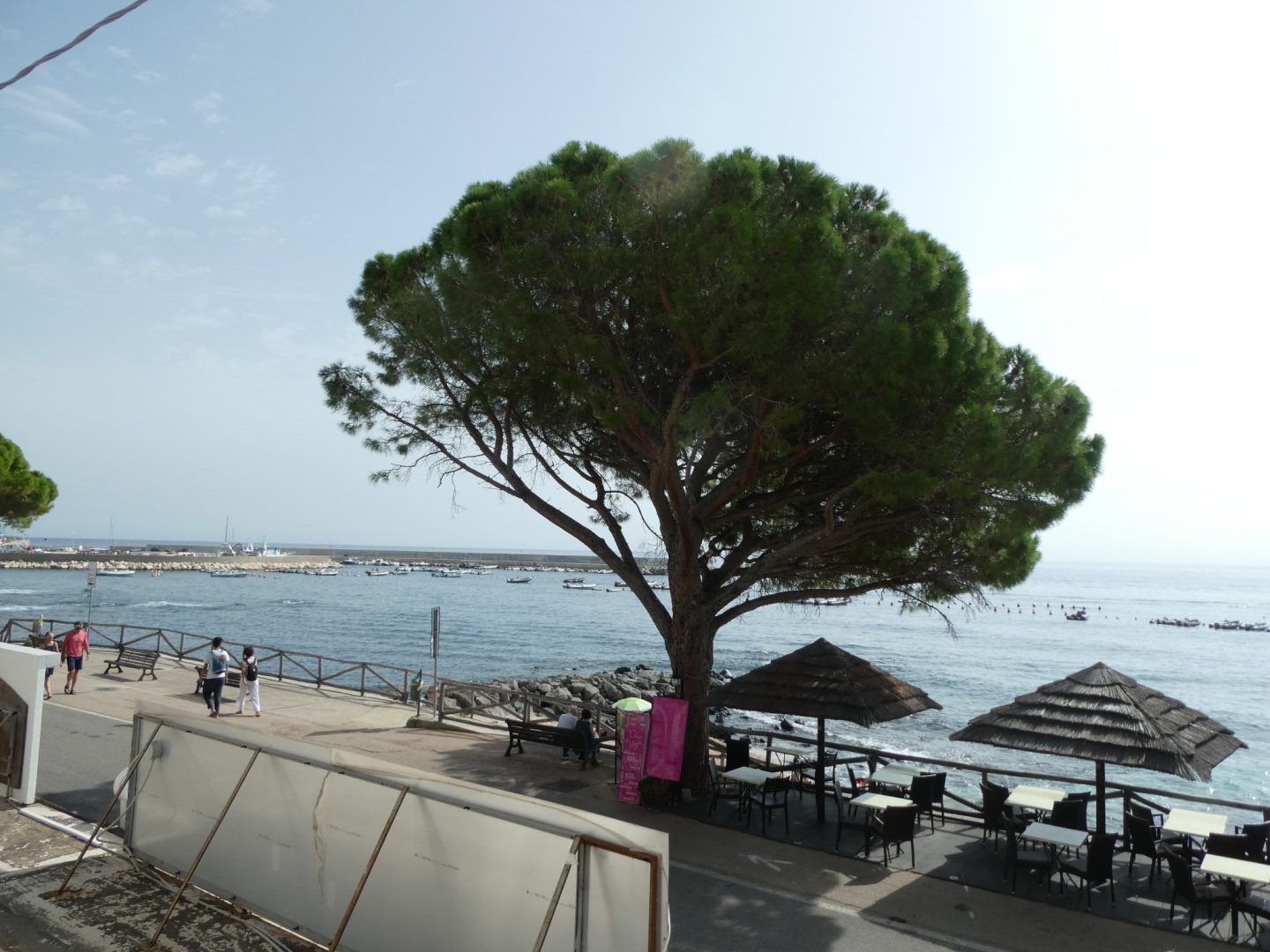
John and Julie did two fantastic dives, a submerged cave dive and a gentle dive over coral encrusted rocky outcrops. A great way to finish.
